
Most of us remember vividly where we were on September 11, 2001. In my case, I was in Danbury, Connecticut in the board room at Bristol Technology meeting with their CEO, Keith Blackwell. Remember where you were when you first heard that President Kennedy was assassinated, 53 years ago this week? (or when Jerry Garcia died if you are too young to remember JFK). Most of us remember major events and exactly where we were at the time — even if it was decades before. Things like that you just don’t forget. But do you remember exactly where you were? I mean the exact latitude and longitude. I didn’t remember exactly where I was when JFK died either; that is until I went back to Lehigh University for my 30th reunion with my handheld GPS receiver (there was no iPhone or car GPS back then) and captured the precise coordinates. A nearby building had been torn down and a new one constructed but dead reckoning got me to the exact spot. This might have seemed strange in 1995 when I wrote the first version of this story.
There are so many occasions when time and place get recorded. Auto accidents, package deliveries, construction sites, interviews, meetings and events of all kinds. We capture the time with great precision; e.g. Saturday July 4, 1998 at 2:15 PM. At times, we also record the location: e.g. IBM Corporate headquarters in Armonk, New York. We could be much more precise, however. How about N41° 06.774′, W73° 43.043′ (41 degrees, 6.774 minutes north and 73 degrees, 43.043 minutes west)?
Location (place) awareness has been an integral part of the history of mankind and the development of modern society. We don’t give it much thought, but location and navigation are inextricable parts of how us humans operate. Most of us have a built in ability to find our way around using “dead reckoning”. Since the beginning of time, man has noticed that stars provide a handy reference where landmarks are not available. Polynesians were able to travel great distances to tiny islands using only wind, waves, and the stars with nothing more significant than the width of an outstretched hand or finger. To study navigation and location is to study Columbus, Magellan, Lewis and Clark, Byrd, Armstrong, or Aldrin and Collins — Apollo 13’s famous “Earth limb shot”. Not to mention the scientists that made it possible. Galileo, Copernicus, Kepler, Huygens, Fourier, Newton, Morley, Einstein, Marrconi, Mercator, Euler, and Gauss just to name a few!
Trade, commerce, and free societies are not possible without location awareness. In a sense it is the very essence of our being. Primarily because of the different availabilities of technology, we were able to have time awareness long before we had location awareness, even though the two are so intimately tied together. New GPS technology closes the gap. (not new now, but new in 1995).
Over time we will start to think of the precision of place as being just as important as the precision of time. Starting with the advent of consumer GPS and into the future, there will be no uncertainty about when and where somebody meant when they refer to location information; especially with the incredible GPS devices such as those from Garmin and Magellan and now built into our smartphones. These amazing devices are powerful handheld computers. They capture your precise location very quickly, tell you your speed and direction, store routes and hundreds of waypoints and enable you to back-track over a course to the starting point or points along the way. The advent of smaller and smaller silicon germanium chips has made embedded GPS capabilities a reality. After all, what exactly is the physical makeup of a GPS receiver? They have a microprocessor chip set of some kind, navigation keys, display, and an antenna. Which of these does a cell phone have? How about a camera? Could these non-GPS devices capture a conversation or a picture and supplement that data with a person’s precise lattitude and longitude? With the iPhone and iPhoto, they call it “Places”.
In 1995, I was imagining that every camera would have a GPS capability in it. Now that it has happened, there is no longer a question as to the legitimacy of certain pictures that depict something that was to have happened — whether it is an accident of some kind or a special event. You might even cryptographically sign the picture plus the coordinates with your digital certificate and thereby establish authentication and non-repudiation of the event. Or imagine that you find yourself lost in an unfamiliar city but since you have your smartphone with you with a digital readout, it can point you to the nearest library, ATM machine or hospital. One startup built a mobile phone for Muslims that has a built in pointer to Mecca.
In the 2003 version of this story, I said we were about to enter an age where an explosion of new data is going to be generated. All of it will find its way into databases, Web servers, new applications and be available for user access. This is part of the Fast, Always On, Everywhere, Natural, Intelligent, Easy, and Trusted world I wrote about in Net Attitude (2001). It may have sounded bold then, but an understatement today.
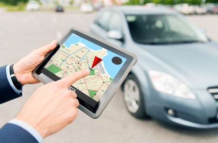
![]() Map of precise spot at Lehigh University at time of JFK assassination. Note: This is an edited version of a story I wrote in 1995. Most of the links should be valid. Copyright: John R. Patrick 1995 2003 2011 2013 2015
Map of precise spot at Lehigh University at time of JFK assassination. Note: This is an edited version of a story I wrote in 1995. Most of the links should be valid. Copyright: John R. Patrick 1995 2003 2011 2013 2015